
{{product.productLabel}} {{product.model}}
{{#if product.featureValues}}{{product.productPrice.formattedPrice}} {{#if product.productPrice.priceType === "PRICE_RANGE" }} - {{product.productPrice.formattedPriceMax}} {{/if}}
{{#each product.specData:i}}
{{name}}: {{value}}
{{#i!=(product.specData.length-1)}}
{{/end}}
{{/each}}
{{{product.idpText}}}

... covers what are necessary to acquire, before return to the office. Portable carrying case for easy transport and secure storage A portable carrying case is provided to protect the system ...
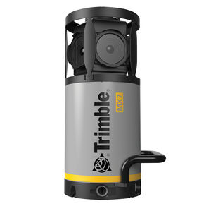
Easy mobile image capture system. The Trimble® MX7 mobile mapping system makes it easier for your team to manage assets. Collect 360-degree images in ...

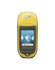
● HD large 5inch touch screen which fulfill the Android users needs● Double OS options: WEH or Android● Android version supports multiple languages switch● Quad-Core 1.3GHz processor● Micro-USB port and OTG function● Being equipped ...
South Surveying & Mapping Instrument Co., Ltd
... more than 9 hours continuous work ●Fully compatible with Carlson SurvCE and FieldGenius ●Windows Mobile 6.5 operating system
South Surveying & Mapping Instrument Co., Ltd
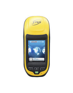
MODEL:S750 ●220 all-in-view channels ●L1 GPS & GLONASS & BDS signals tracking performance ●Powerful and user-friendly fieldwork software ●Easy to access to CORS with built-in 3G communication module ●Fully compatible ...
South Surveying & Mapping Instrument Co., Ltd
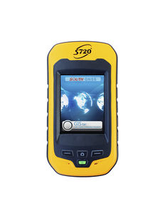
MODEL:S720 ●Professional surveying-type GPS board ●Easy to use smartphone form factor ●3.5 inch, sunlight-readable VGA LED ●Professional software for GIS workflows ●Bluetooth, WIFI and Mobile communication modules
South Surveying & Mapping Instrument Co., Ltd

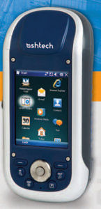
... MobileMapper® 120 is the newest generation of handheld mapping devices from Spectra Precision. Designed for GIS data collection and mapping, the MobileMapper 120 integrates an open ...
Spectra Precision
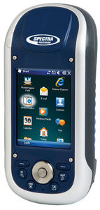
MobileMapper 100 is the newest generation of GNSS handheld mapping devices introduced by Spectra Precision. Designed for GIS data collection and mapping, the MobileMapper 100 integrates ...
Spectra Precision
Geographical Information Systems and Location Based Services are strongly penetrating a wide range of applications and organizations. The growing need for geo-localization is naturally boosting the demand for efficient ...
Spectra Precision

... floor plan of a building, either for public safety needs or as the basis for renovation or expansion. The FARO ScanPlan 2D Handheld Mapper makes it easy — just attach your phone and start scanning. Lightweight and easy ...
the best suppliers
Please specify:
Help us improve:
remaining