Interface software TcpTUNNEL for Spectra Geospatialtrackingpositioningsurveying

Add to favorites
Compare this product
Characteristics
- Function
- interface, tracking, positioning
- Applications
- surveying
- Operating system
- Windows
- Other characteristics
- Bluetooth
Description
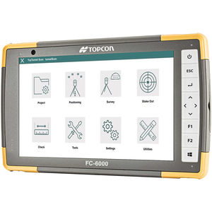
TcpTunnel for Spectra Geospatial installs on a Windows tablet with Bluetooth interface connected to Spectra Geospatial FOCUS 35 total station.
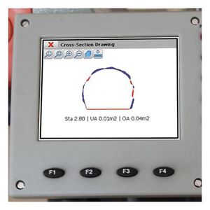
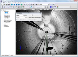
The cross sections are measured automatically, simply giving the desired interval and the number of points per profile. The application shows the theoretical and as-built tunnel sections, with top and front views, displaying underbreak and overbreak areas.
The program allows the staking out of the funnel face, points of the tunnel template, rock bolts, road surface and more.
Each project is defined by the horizontal and vertical
alignments and the tunnel templates, which can be
imported from TBC or LandXML, converted from a CAD
drawing, defined by parameters or points measured with
a total station.
Positioning and Orientation
As a prior step to surveying and setting out, the station
should be positioned and oriented by coordinates, angle
or resection. User can select between local and
projected coordinates.
Surveying
TcpTunnel performs automatic and unattended
cross-section measurements for each station, defined by
intervals of angle, arc length or height difference.
Special points and road layers can be measured, and
exclusion areas defined as well. It is also possible to
measure a grid, in conventional or tracking mode, giving
two corners or a range of horizontal and vertical angles.
VIDEO
Catalogs
No catalogs are available for this product.
See all of Aplitop‘s catalogsRelated Searches
- Automation software solution
- Management software solution
- Analysis software solution
- Windows software solution
- Computer-aided design software
- Control software solution
- Online software
- Design software solution
- 3D software solution
- Interface software
- Measurement software
- Simulation software
- Visualization software solution
- EDM software
- 2D software
- Creation software
- Reporting software solution
- Modeling software
- Planning software
- Calculation software
*Prices are pre-tax. They exclude delivery charges and customs duties and do not include additional charges for installation or activation options. Prices are indicative only and may vary by country, with changes to the cost of raw materials and exchange rates.


