- Robotics - Automation - Industrial IT
- Industrial Software
- Design software
- Bentley Systems Europe B.V.

- Products
- Catalogs
- News & Trends
- Exhibitions
Calculation software OpenFlows SewerGEMSdesignmanagementSCADA
Add to favorites
Compare this product
Characteristics
- Function
- creation, management, analysis, engineering, modeling, SCADA, design, reporting, planning, calculation, mapping
- Applications
- network, color, hydraulic, for water systems
- Type
- 3D, 2D, 1D
- Operating system
- Windows
- Other characteristics
- AutoCAD
Description
Produce Optimal Urban Sewer Planning and Overflow Remediation Analysis Designs
Model from within several platforms while accessing a single, shared project data source.
WHAT IS OPENFLOWS SEWERGEMS?
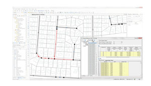
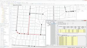
OpenFlows SewerGEMS enables you to produce optimal urban sewer planning and overflow remediation analysis designs in an easy-to-use environment. You can design and operate sanitary or combined conveyance sewer systems by using built-in hydraulic and hydrology capabilities with a variety of dry- and wet-weather calculation methods. Better understand surface flood depth and velocity, flood hazard, and inundation times with the new user-friendly 1D/2D hydraulic analysis capability.
Access A Single, Shared Project Data Source
Collaborate without surrendering individual skills, maintaining a single modeling data set without restrictions. Model within Windows, ArcGIS, AutoCAD, OpenRoads, OpenSite, or OpenRail.
1D/2D Hydraulic Analysis
User-friendly tools connect 1D network elements with 2D surface flows. Better understand surface flooding depth and velocity, flood hazard, and inundation times, and communicate this information to stakeholders with versatile mapping and reporting tools.
Understand Results More Easily
Spot bottlenecks and potential surcharging with animated 3D graphs and profiles. Use color coding, element symbology, and annotation to visualize input and results.
Other Bentley Systems Europe B.V. products
Hydraulics and Hydrology
Related Searches
- Bentley automation software
- Bentley management software
- Bentley analysis software
- Bentley process software
- Bentley Windows software
- Bentley CAD software
- Control software solution
- Bentley real-time software
- Bentley cloud software
- Bentley design software
- Bentley 3D software
- Interface software
- Industrial software solution
- Bentley quality software
- Bentley simulation software
- Bentley visualization software
- Programming software
- Automated software
- Development software
- Bentley network software
*Prices are pre-tax. They exclude delivery charges and customs duties and do not include additional charges for installation or activation options. Prices are indicative only and may vary by country, with changes to the cost of raw materials and exchange rates.


