- Robotics - Automation - Industrial IT
- Industrial Software
- CAD software
- Bentley Systems Europe B.V.

- Products
- Catalogs
- News & Trends
- Exhibitions
CAD software OpenCities Mapmodelingcreationengineering
Add to favorites
Compare this product
Characteristics
- Function
- engineering, modeling, CAD, creation, server, editing, acquisition
- Applications
- for map processing
- Type
- 3D, 2D
- Deployment mode
- online
Description
Engineering Modeling Capabilities in a Geospatial Environment
Efficiently document and model assets in a 2D or 3D geospatial environment. OpenCities Map products seamlessly and intuitively integrate with the most common spatial databases including Oracle Spatial, SQL Server Spatial, PostgreSQL (PostGIS), and Esri (FGBD, ArcGIS Server and online). Establishing a single source of truth for your entire 2D and 3D dataset provides up-to-date data for everyone who needs access.
What is OpenCities Map PowerView?
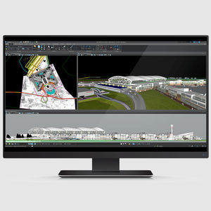
OpenCities Map PowerView enables you to view map assets and perform light 2D feature acquisition and editing. It supports GPS and editing capabilities, making it ideal for field-based operations that require feature editing. It is an entry-level product to view and edit 2D geospatial information. OpenCities Map PowerView offers placement methods that convert CAD element creation tools into feature-based element creation tools. CAD users can continue to use familiar MicroStation capabilities to create feature-based map elements without learning a new workflow. You can also create in-house placement methods for more specific needs.
OpenCities Map Advanced Computer Software Screen Mockup
What is OpenCities Map Advanced?
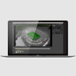
OpenCities Map Advanced includes a rich set of capabilities that substantially increase productivity by enabling feature-based modeling workflows through its schema file. It allows you to define a set of features to be captured along with their related properties, symbology, annotation, and behaviors.
Other Bentley Systems Europe B.V. products
CAD Modeling and Visualization
Related Searches
- Bentley automation software
- Bentley management software
- Bentley analysis software
- Bentley Windows software
- Bentley process software
- Bentley CAD software
- Control software solution
- Bentley real-time software
- Bentley cloud software
- Bentley design software
- Bentley 3D software
- Interface software
- Industrial software solution
- Bentley quality software
- Bentley simulation software
- Bentley visualization software
- Programming software
- Automated software
- Development software
- Bentley network software
*Prices are pre-tax. They exclude delivery charges and customs duties and do not include additional charges for installation or activation options. Prices are indicative only and may vary by country, with changes to the cost of raw materials and exchange rates.


