CAD data analysis software automationautomatedWindows
Add to favorites
Compare this product
Characteristics
- Function
- CAD data analysis, automation
- Type
- automated
- Operating system
- Windows, 32/64-bit Windows system
- Deployment mode
- cloud
Description
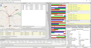
A modular program that provides the ability to go from field scan to finished plat, Carlson Point Cloud delivers powerful automation for large data sets. View and process up to 1 billion points all with Carlson ease-of-use.
Point Cloud is available in Basic or Advanced versions.
KEY FEATURES
• Register scans to local coordinates, filter or decimate the points, and overlay raster images in 3D
• Snap to edges and code descriptions for automated field-to-finish processing of linework and symbols
• Create contours, profiles, sections, and breaklines from within the point cloud
Lastly, all surface models, points, contours, breaklines, grid and profiles can be exported to CAD
Catalogs
No catalogs are available for this product.
See all of Carlson Software‘s catalogsRelated Searches
- Automation software solution
- Management software solution
- Analysis software solution
- Process software solution
- Windows software solution
- Computer-aided design software
- Control software solution
- Real-time software solution
- Online software
- Design software solution
- 3D software solution
- Monitoring software solution
- Measurement software
- Quality software
- Simulation software
- Automated software
- Network software solution
- EDM software
- 2D software
- Optimization software solution
*Prices are pre-tax. They exclude delivery charges and customs duties and do not include additional charges for installation or activation options. Prices are indicative only and may vary by country, with changes to the cost of raw materials and exchange rates.


