Modeling software for the mining industry3D
Add to favorites
Compare this product
Characteristics
- Function
- modeling
- Applications
- for the mining industry
- Type
- 3D
Description
The Carlson Geology Module uses drillholes, channel samples, and user-defined 3D polyline data to create accurate and easy-to-use geologic models. A variety of industry-standard modeling algorithms are available, allowing you to create stratigraphic grid models and block models that are realistic, reproducible, and reliable.
DRILLHOLES
• Import from any format using custom settings
• Store drill data directly in the CAD drawing or dynamically link to external databases
• Draw geologic columns in section-view or in 3D to correlate strata
• Validate holes with queries and reports
• Use tools such as Strata Polylines, Horizon Codes, and Drillhole Equations to build complex models
• Import E-Log geophysical LAS files and core images
MODELING
• Use industry-standard modeling algorithms and supporting commands to ensure accurate representation of the geology
• Create macros to update models with new data
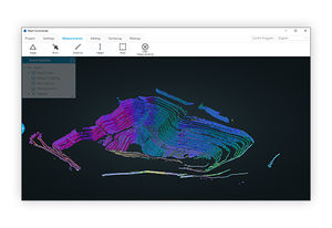
• Investigate models with inspection tools and colored, hatched isopachs
• Enhance models with Limit Lines and Strata Polylines for detailed strata behavior
• Automatically model strata pinchout and seam splits
• Account for incomplete drilling with conformance settings
• Compare Geologic Models and user-modified Mining Models to quantify available vs. recoverable reserves
CROSS-SECTIONS & FENCE DIAGRAMS
• Plot geologic cross-sections or view in realtime with dynamic section line adjustment
• Color cross-sections by strata or grade and plot drillholes for reference
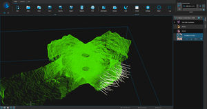
• Stack up sections in 2D, or draw in 3D to visualize with existing topography and mine designs
• Generate accurate dragline range diagrams on actual geologic models
Catalogs
No catalogs are available for this product.
See all of Carlson Software‘s catalogsRelated Searches
- Automation software solution
- Management software solution
- Analysis software solution
- Process software solution
- Computer-aided design software
- Windows software solution
- Control software solution
- Online software
- Real-time software solution
- Design software solution
- 3D software solution
- Monitoring software solution
- Measurement software
- Quality software
- Simulation software
- Automated software
- Network software solution
- EDM software
- 2D software
- Optimization software solution
*Prices are pre-tax. They exclude delivery charges and customs duties and do not include additional charges for installation or activation options. Prices are indicative only and may vary by country, with changes to the cost of raw materials and exchange rates.


