- Metrology - Laboratory
- Inspection and Monitoring
- Helicopter UAV
- Carlson Software
Helicopter drone EVO II Pro RTKmappingaerial photography

Add to favorites
Compare this product
Characteristics
- Type
- helicopter
- Applications
- mapping, aerial photography
- Endurance
Max.: 36 min
Min.: 0 min
- Payload
1,237 g
(43.634 oz)
Description
The EVO II Pro RTK provides a proven, accurate, durable, and user-friendly, FAA Remote ID Compliant Unmanned Aircraft System (UAS) for numerous applications, including the creation of surfaces, point clouds, and orthoimages with Carlson PhotoCapture, as well as feature extraction and CAD plans with Carlson Point Cloud.
Available in packages with both PhotoCapture and Carlson Point Cloud to take your aerial data to finished deliverables, the EVO II Pro offers up to 36 minutes of flight time, high accuracy positioning with its detachable RTK module, a 20MP camera with 1″ sensor, and built-in mission planning for simple setup in the field.
What's Included
EVO II Pro RTK packages from Carlson include:
• Aircraft with RTK module
• 3 Flight batteries
• Smart Controller with mission planning software
• 10 ground targets
• Chargers and cables
• 32gb SD card
• Controller neck strap
• Rugged hard case
• Spare propeller pair
Create Point Clouds, Orthoimages, TINs, Linework, and More With Carlson PhotoCapture
With Carlson PhotoCapture drone photo processing software, you can use the date collected with your EVO II Pro RTK to:
• Quickly generate interactive 3D maps of sites
• Capture highly accurate 3D site data from any camera
• Share site maps with customers – anywhere, anytime!
• Save man-hours in the field
Carlson Listen-Listen & BRx7 for RTK Anywhere
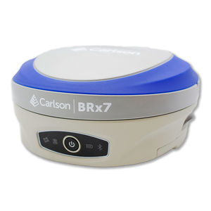
Carlson Listen-Listen is a cloud-based service that sends corrections over the cellular data network from a base BRx7 to a rover or RTK drone. Available to Carlson SurvCE and SurvPC customers using Carlson’s BRx7 GNSS receiver as a base station, the system eliminates the need for network corrections
VIDEO
Catalogs
No catalogs are available for this product.
See all of Carlson Software‘s catalogsRelated Searches
*Prices are pre-tax. They exclude delivery charges and customs duties and do not include additional charges for installation or activation options. Prices are indicative only and may vary by country, with changes to the cost of raw materials and exchange rates.


