- Robotics - Automation - Industrial IT
- Industrial Software
- Control software
- CHENGDU JOUAV DAPENG TECH CO.,LTD

- Products
- Catalogs
- News & Trends
- Exhibitions
Analysis software Eagle Mapcontrolsafetyinspection

Add to favorites
Compare this product
Characteristics
- Function
- analysis, control, safety, inspection
- Applications
- process, industrial, surveying, for UAVs
- Type
- 3D, real-time, 2D
Description
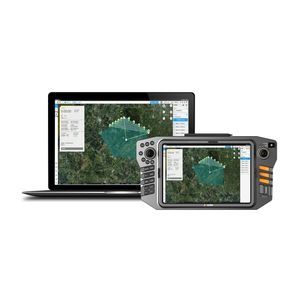
Automate drone flight missions, live video feed, AI-based detection, and data processing
Specifically designed for JOUA UAV products, Eagle Map is mainly used for power line inspection, emergency response, search and rescue, etc. Together with JOUAV's flight control system, the software not only ensures the stability and safety of the drone but is also easy to operate.
Benefits and Features
Eagle Map can automatically generate routes according to different gimbal cameras and transmits 1080P HD real-time videos to the ground station. In addition to that, it can also generate orthomosaic maps based on the keyframes of the live video.
3D Mission Previews of Your Entire Mission Plan
It helps you plan, simulate, and control your drone’s trajectory more accurately for safer flight
Automatic Route Generation Based on Different Gimbal Cameras
The software eliminates the manual workflows and it’s ideal for both beginners and advanced users
AI-based Object Detection and Tracking
It can detect objects while flying and allows the analysis and recording of information on the ground.
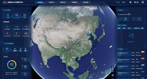
Project Real-time Video ontop the 3D map of the Ground Station
This shows the environmental danger and location of the affected area, enhancing people's situational awareness.
Real-time Video Stitching to Generate Orthophotos
2D orthomosaic maps are created simultaneously with the real-time video, providing situational information for security teams.
Live Video Transmission down to 300ms
Transmit 1080P HD live video footage to the ground station via a dedicated data link and allow more officers to see the video from their mobile devices.
VIDEO
Other CHENGDU JOUAV DAPENG TECH CO.,LTD products
Software
Related Searches
- Automation software solution
- Management software solution
- Analysis software solution
- Process software solution
- Control software solution
- Online software
- Real-time software solution
- 3D software solution
- Measurement software
- Interface software
- Industrial software solution
- EDM software
- 2D software
- Planning software
- Safety software
- Inspection software
- Product lifecycle management software
- All-in-one software
- Sharing software
- Mapping software
*Prices are pre-tax. They exclude delivery charges and customs duties and do not include additional charges for installation or activation options. Prices are indicative only and may vary by country, with changes to the cost of raw materials and exchange rates.


