- Robotics - Automation - Industrial IT
- Industrial Software
- Control software
- CHENGDU JOUAV DAPENG TECH CO.,LTD

- Products
- Catalogs
- News & Trends
- Exhibitions
Management software Jocloudmeasurementcontrolplanning
Add to favorites
Compare this product
Characteristics
- Function
- management, measurement, control, planning, sharing, mapping, labeling
- Applications
- process, industrial
- Type
- 3D
Description
Intelligent unattended system management platform
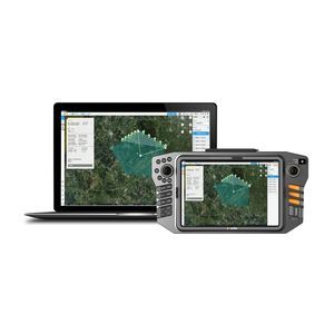
JOUAV's Jocloud management platform is designed to manage the JOUAV Unattended System and its drones. The platform offers 3D route planning, route task management, simultaneous control of multiple drones, map information labeling and sharing, full dynamic video application, and AI recognition algorithms. Additionally, the system generates a detailed electronic flight report after each UAV flight.
Benefits and Features
Jocloud is an intelligent UAV management platform that provides data statistics, basic GIS map services, route trajectory, equipment management, team management and other functions.
3D Route Planning
Based on 3D GIS map, Jocloud Management Platform provide ground-aware area and route search with ground-like routes
Multi-level Task Assignment
By the task requirements, superiors can effortlessly assign route missions to subordinates remotely with just a click, making the process of task delegation smooth and effortless.
Multiple Drones with One Controller
Multiple UAVs can be controlled remotely at the same time, enhancing the cooperative operation capability of UAVs.
Map Marking, Measurement and Sharing
The key targets can be marked, measured, and shared on the map with other members to provide quantitative data for situational research and timely decision-making.
Full Dynamic Video
Integrated transmission solution with point, line and surface mapping and measurement in the dynamic video, synchronized with GIS map display, and share the marking information with other members.
Other CHENGDU JOUAV DAPENG TECH CO.,LTD products
Software
Related Searches
- Automation software solution
- Management software solution
- Analysis software solution
- Process software solution
- Control software solution
- Online software
- Real-time software solution
- 3D software solution
- Measurement software
- Interface software
- Industrial software solution
- EDM software
- 2D software
- Planning software
- Safety software
- Inspection software
- Product lifecycle management software
- All-in-one software
- Sharing software
- Mapping software
*Prices are pre-tax. They exclude delivery charges and customs duties and do not include additional charges for installation or activation options. Prices are indicative only and may vary by country, with changes to the cost of raw materials and exchange rates.


