Teleoperated UGV inspectionfor pipe inspection cameras
Add to favorites
Compare this product
Characteristics
- Type
- teleoperated, inspection, for pipe inspection cameras
Description
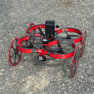
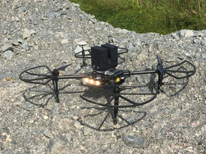
This robotic vehicle comes with a remote controller with a display unit for easy control especially in non-line-of-sight situations. The 360 degree camera has pan, tilt and zoom functions to allow inspection while driving the vehicle. The system is especially designed for rugged environments and can drive over obstacles. It is also capable of climbing stairs.
The 3D mapping system is based on Clickmox Solution’s proprietary software that allows generation of accurate point cloud on the fly. From the point cloud, the system generates the map in three dimensions. During real time processing, the position of the scanner is also calculated, which can be used for autonomous operation.
The system comes with modeling software to help create meshes and surfaces over the point clouds. The software can also be used to register the point cloud with the local coordinate system. The is generally desirable in mining operations to facilitate archiving the map in mine CAD system for mine designing and future reference.
Clickmox provides onsite hands-on training to ensure proper operation of the system by mine personnel.
VIDEO
Catalogs
No catalogs are available for this product.
See all of CLICKMOX‘s catalogs*Prices are pre-tax. They exclude delivery charges and customs duties and do not include additional charges for installation or activation options. Prices are indicative only and may vary by country, with changes to the cost of raw materials and exchange rates.


