Inspection unmanned ground vehicle teleoperated
Add to favorites
Compare this product
Characteristics
- Type
- inspection, teleoperated
Description
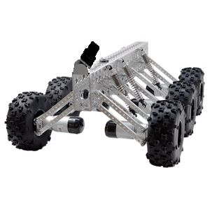
- Light duty vehicle scanner is specially developed for multipurpose scanning options in mining industry as well as in civil strictures. The system is uniquely built and customised by exploiting rugged, versatile and powerful off-road robot, and a 3D high precision laser scanner to survey and map narrow spaces and other challenging environments in underground mines.
It employs Simultaneous Localization And Mapping (SLAM) algorithm to combine the 2D laser scan data with the laser sensor position to generate accurate 3D point clouds. The VM-SCAN3D system which makes use of two laser sensors simultaneously, enables rapid data capture of 3D point cloud with real time or off-line map generation. This competitively priced system can be used by anyone, including those new to surveying and laser scanning. Accurate 3D point clouds are rapidly captured for further processing and analysis.
The 3D mapping system is based on Clickmox Solution's proprietary software that allows generation of accurate point cloud on the vehicle. From the point cloud, the system generates the map in three dimensions. The process of map generation is accomplished in real time, which can be seen in the monitor attached to the unit. During real time processing, the position of the scanner is also calculated, which can be used for autonomous operation.
KEY FEASTURES
- Creates 3D point cloud and map on the Mantis
- Robust and cost effective 3D visualization, localization and mapping
- Based on SLAM algorithm for positioning and mapping
Catalogs
No catalogs are available for this product.
See all of CLICKMOX‘s catalogs*Prices are pre-tax. They exclude delivery charges and customs duties and do not include additional charges for installation or activation options. Prices are indicative only and may vary by country, with changes to the cost of raw materials and exchange rates.


