- Robotics - Automation - Industrial IT
- Industrial Software
- Positioning software
- Eliko Location Technologies OU

- Company
- Products
- Catalogs
- News & Trends
- Exhibitions
RTLS software positioninglocatingsocial distancing
Add to favorites
Compare this product
Characteristics
- Function
- positioning, locating
- Applications
- RTLS, social distancing
- Type
- real-time
Description
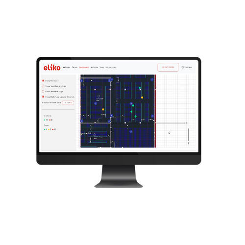
RTLS Software enables to position tags in a network of RTLS anchors. RTLS Software has a number of functionalities. The Eliko RTLS enables users to create business rules and specific configurations according to tag type or other information.
GEOFENCES AND DYNAMIC CONFIGURATION
The Eliko RTLS system enables the configuration of geofences or zones of any shape. Geofences/Zones can be used to get useful contextualized positioning information from configured areas. For example, to measure time spent in a specific area. Real-time information about which tag is in which defined geolocation is also available.
EVENTS STREAM
The Eliko RTLS is able to send third party applications an events stream based on geofences/zones, such as when a specific tag or a tracked object enters or leaves a geofence. It is also possible to use the event stream for detecting close encounters between different tags, or types of tracked objects. This can be useful for social distancing or collision avoidance.
ALARMS AND TAG ACCESSORIES
The Eliko RTLS system allows users to configure real time alarms for tags. These alarms can be visual (LED blinking) and vibration (internal vibration motor). Alarms can be triggered with manual commands or configured by a third-party system to send them automatically through the API. Further alarms can be also configured using geofences.
API
Eliko RTLS offers multiple API options for integrating with ERP/MES/Scada platforms.
Catalogs
No catalogs are available for this product.
See all of Eliko Location Technologies OU‘s catalogsExhibitions
Meet this supplier at the following exhibition(s):

Other Eliko Location Technologies OU products
Eliko RTLS Tracking Solution
*Prices are pre-tax. They exclude delivery charges and customs duties and do not include additional charges for installation or activation options. Prices are indicative only and may vary by country, with changes to the cost of raw materials and exchange rates.


