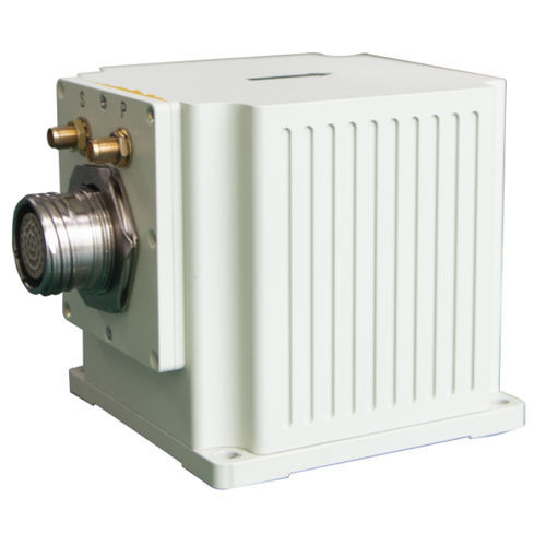
Lightweight inertial navigation system Type 50GNSSmobileintegrated
Add to favorites
Compare this product
Characteristics
- Options
- GNSS, lightweight
- Mounting
- integrated, mobile
Description
Type 50 Optical Fiber Integrated Navigation System, a cutting-edge solution meticulously engineered to provide unrivaled performance. This system encompasses a compact and lightweight three-axis integrated closed-loop fiber optic gyroscope, accelerometer, and guidance card, offering exceptional cost-effectiveness. Leveraging advanced multi-sensor fusion and navigation algorithms, it delivers precise measurements of attitude, heading, and position information with remarkable accuracy.
Designed with versatility in mind, the Type 50 system finds its perfect application in medium to high precision mobile measurement systems and medium to large unmanned aerial vehicles (UAVs). Its seamless integration and reliable performance make it an invaluable asset for various industries, including surveying, mapping, aerial photography, and more.
Experience the pinnacle of navigation technology with the Type 50 Optical Fiber Integrated Navigation System, enabling you to unlock new levels of precision and efficiency in your operations.
MAIN FUNCTION
The system offers a combined inertial/satellite navigation mode and a pure inertial mode.
In the inertial/satellite integrated navigation mode, the internal GNSS receiver uses the satellite positioning information for integrated navigation and outputs the carrier’s pitch, roll, heading, position, speed, and time information. When the signal is lost, the output includes the position, velocity, and attitude calculated by inertia, with a requirement to maintain accurate pitch and roll, along with a short-term course holding function and meter-level positioning accuracy.
Catalogs
No catalogs are available for this product.
See all of ERDI TECH LTD‘s catalogsRelated Searches
- Tilt sensor
- Digital tilt sensor
- Analog tilt sensor
- High-precision tilt sensor
- Rangefinder
- Laser rangefinder
- Inertial navigation unit
- Gyroscope
- Portable rangefinder
- GNSS INS
- IMU
- Single-axis gyroscope
- Fixed rangefinder
- Digital gyroscope
- Lightweight INS
- Aeronautic gyroscope
- 3-axis tilt sensor
- Gyroscope for marine applications
- Inertial tilt sensor
- Metric rangefinder
*Prices are pre-tax. They exclude delivery charges and customs duties and do not include additional charges for installation or activation options. Prices are indicative only and may vary by country, with changes to the cost of raw materials and exchange rates.


