
- Company
- Products
- Catalogs
- News & Trends
- Exhibitions
Data analysis software GeoDASmonitoringengineeringconfiguration

Add to favorites
Compare this product
Characteristics
- Function
- data analysis, monitoring, engineering, configuration, data acquisition, acquisition, data analysis
- Applications
- instrument, for civil engineering, seismology
- Operating system
- Windows, Linux
Description
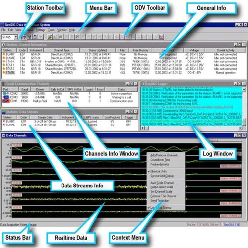
GeoDAS is a graphical Microsoft Windows-based application. It provides the most comprehensive, intuitive and versatile features available in the earthquake, seismic, structural, dynamic and static monitoring and measuring industry. Fundamentally the program is used for instrument configuration and for acquisition of data provided by any standard GeoSIG instrument. . All recent Windows versions are supported, down to Windows 7. It may work also on the obsolete Windows XP but we no longer support it.
Virtual machines or wrapper applications can be used to enable its many features to run under Linux, Mac OS, Unix and other operating systems too.
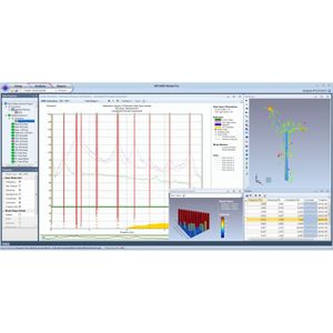
The GeoDAS-COM package includes the GeoDAS-BASE package and specific basic cables and hardware certified to use with the relevant equipment supplied. The Data Analysis part of GeoDAS (GeoDAS-DAP) has been developed by GeoSIG especially for the strong motion, earthquake engineering and civil engineering data analysis. The following operations can be performed:
• Lowpass Filter
• Highpass Filter
• Baseline correction
• Integration
• Differentiation
• Vector Sum
• Cumulative Absolute Velocity (CAV)
• Time-domain Filtering
• Effective Values
• Damping
• Power Spectra
• FFT Magnitude
• Terzband Spectra
• Response Spectra
• JMA Intensity
• STA/LTA Ratio
• Signal Characteristics
• Analysis Templates
The general functionality of GeoDAS briefly described above is used in most applications based on GeoSIG equipment. Moreover special GeoDAS versions (i.e. GeoDAS-AEP, GeoDAS-NPP, etc) offer special functions, some of which are supplied for particular applications or some of which can be activated in special cases only.
VIDEO
Catalogs
Related Searches
- Analysis software solution
- Windows software solution
- Online software
- 3D software solution
- Monitoring software solution
- Measurement software
- Engineering software
- 2D software
- Modeling software
- Calculation software
- Data acquisition software
- Data analysis software solution
- Acquisition software
- Linux software
- Instrument software
- 2D/3D software
- Data analysis software
- Phase software
- Vibration analysis software
- Animation software
*Prices are pre-tax. They exclude delivery charges and customs duties and do not include additional charges for installation or activation options. Prices are indicative only and may vary by country, with changes to the cost of raw materials and exchange rates.


