Satellite positioning system GNPS-42topographymobile
Add to favorites
Compare this product
Characteristics
- Applications
- topography
- Other characteristics
- mobile, satellite
Description
NESTLE Satellite positioning system GNPS-42
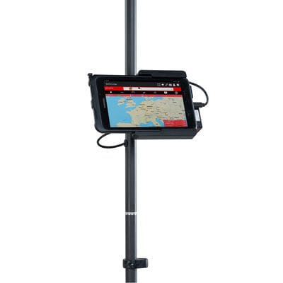
• The NESTLE GNPS-42 is a precise, light, mobile Satellite positioning system for point recording and point setting out in topography, documentation, construction and volume measurements.
• The GNPS-42 system sets standard for entry-level satellite positioning systems.
• Through the simultaneous use of 4 satellite systems (GPS, GLONASS, GALILEO, BEIDOU) measurements can be carry out comfortably.
• The NESTLE on2go app - one of the most user-friendly Software app for construction measurements - can be learned very quickly. We have put special attention during developing the software to users without special knowledge in the field of surveying applications.
• The GNPS-42 system is Made in Germany.
Application benefits
• Simultaneous use of 4 satellite systems (GPS, GLONASS, GALILEO, BEIDOU).
• Satellite measurement system made in Germany.
• Quick and easy to learn.
• Particularly light weight.
• Made in Germany.
Scope of delivery
• Helix antenna
• Pole 2-parts with internal cable routing and vial
• Tablet with Li-Ion battery, charger, pen, outdoor-cover
• GNPS-Sensorbox with connecting cable
• Holder for Tablet and GNPS-Sensorbox
• Pole holder H2C for tablet holder
• Software App NESTLE on2go (one year license)
• Manual
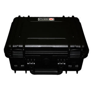
• Bag
Catalogs
GNPS-42
2 Pages
Other Gottlieb Nestle GmbH products
Surveying instruments and accessories
*Prices are pre-tax. They exclude delivery charges and customs duties and do not include additional charges for installation or activation options. Prices are indicative only and may vary by country, with changes to the cost of raw materials and exchange rates.


