- Building - Construction
- Construction tool
- GreenValley International
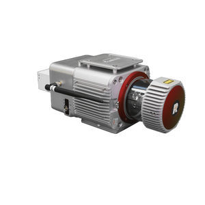
Mapping system LiAir 50N
Add to favorites
Compare this product
Description
powered by Velodyne’s VLP-16 sensor, is GreenValley's most cost-effective UAV LiDAR system. The LiAir 50N is an ideal entry-level system or environments with minimal vegetation coverage.
Overview
The LiAir 50N is a lightweight UAV- or sUAS-mounted LiDAR survey instrument designed and produced by GreenValley International (GVI). This system features a Velodyne's Puck laser scanner and it is one of the most cost-effective LiDAR systems in GVI’s LiAir Series. This lightweight 3D surveying and mapping payload was designed with DJI’s Matrice 600 Pro & DJI M300 RTK series platforms. LiAir 50N is able to provide highly accurate 3D point cloud data and is a great fit for applications in a wide variety of industries. And it is also equipped with a high-definition digital camera, which can be used to generate photogrammetry products as well as true color 3D point clouds.
High Precision
Accuracy meets the requirements of large-scale topographic mapping.
High Efficiency
2 square kilometers by one device per day.
Simple Operation
One-button process data collection, one-button take-off and landing automatically execute the route.
Catalogs
No catalogs are available for this product.
See all of GreenValley International‘s catalogsRelated Searches
*Prices are pre-tax. They exclude delivery charges and customs duties and do not include additional charges for installation or activation options. Prices are indicative only and may vary by country, with changes to the cost of raw materials and exchange rates.


