- Robotics - Automation - Industrial IT
- Industrial Software
- Management software
- GreenValley International
Management software LiStreetinspectionmappingcutting

Add to favorites
Compare this product
Characteristics
- Function
- management, inspection, mapping, cutting
- Applications
- construction, infrastructure
- Type
- 3D, automated
Description
HD-Road Mapping Processing Software
Framework
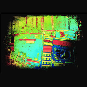
As a feature extraction software for 3D mapping developed by GreenValley International, LiStreet adopts an automated and semi-automated approach to vectorize urban areas, supporting a variety of GIS platforms. The software can be applied to a wide range of fields including municipal management, municipal infrastructure survey, high-definition map generation, highway inspection and expansion, digital city construction, digital garden investigation, etc., elevating the level of informatization and urban management.
Advantages
Automatic Extraction of Lane Line, Light Pole, and Road Edges
Generate tiles from the cutting block tool
Panoramic Measurement
Extraction of Road Marks
VIDEO
Catalogs
No catalogs are available for this product.
See all of GreenValley International‘s catalogsRelated Searches
- Management software solution
- Analysis software solution
- Process software solution
- Real-time software solution
- Online software
- 3D software solution
- Measurement software
- Quality software
- Visualization software solution
- Automated software
- EDM software
- 2D software
- Reporting software solution
- Data management software solution
- CAM software
- Inspection software
- Construction software
- Product lifecycle management software
- Editing software
- Infrastructure software
*Prices are pre-tax. They exclude delivery charges and customs duties and do not include additional charges for installation or activation options. Prices are indicative only and may vary by country, with changes to the cost of raw materials and exchange rates.


