- Robotics - Automation - Industrial IT
- Automation
- UHF receiver
- Hi-Target Surveying Instrument Co.,Ltd
- Company
- Products
- Catalogs
- News & Trends
- Exhibitions
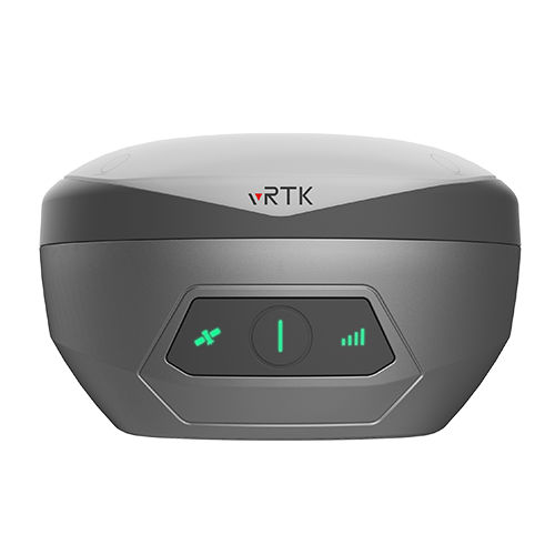
RTK receiver vRTKGNSSsatelliteUHF

Add to favorites
Compare this product
Characteristics
- Type
- GNSS, UHF, RTK, satellite
- Applications
- industrial, for surveying, tracking, harsh environment
- Interface type
- USB
- Other characteristics
- compact, multi-channel, with integrated antenna, high precision, IP68
Description
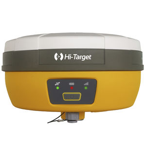
Equipped with professional dual cameras, vRTK is Hi-Target’s first lightweight and innovative visual RTK receiver product, which not only enables non-contact image surveying, breaking through the objective constraints of previous work, but also improves the speed of stakeout with the function of Live View Stakeout. It greatly improves the work efficiency of engineering users.
Dual Cameras for Image Survey and Live View Stakeout
Non-contact measurement greatly improves the usable range of GNSS and efficient safe operation.
Strong Signal and High-quality Data
-New generation GNSS SOC chip with 1408 channels, supports new frequency points B1C, B2a, and B2b RTK decoding for Beidou-3 Satellites.
-Introduction of multi-frequency anti-jamming technology and multi-step adaptive filtering technology to ensure strong signals, high-quality data, fast fix, and high accuracy.
Abundant Industry Data Results
-Abundant types of data results meet the needs of different industry applications.
-Compatible with the mainstream modelling software to attain point cloud and 3D modelling in one step.
Product Parameters
8mm+0.7mm/°tilt
Tilt Survey Accuracy
1408/1760
Channels
2cm
Image Stakeout Accuracy
2cm ~ 4cm
Image Survey Accuracy
Built-in 8GB ROM
Data Storage
VIDEO
Catalogs
Hi-Target catalog-20230907s
20 Pages
Hi-Target/GNSS Receiver/vRTK
4 Pages
Other Hi-Target Surveying Instrument Co.,Ltd products
GNSS RTK
Related Searches
- GNSS antenna
- IP67 antenna
- GPS antenna
- External antenna
- Hi-Target radio receiver
- Hi-Target GNSS receiver
- Measurement antenna
- Hi-Target compact receiver
- Serial receiver
- Rugged receiver
- Hi-Target RTK receiver
- Hi-Target multi-channel receiver
- GLONASS antenna
- Industrial receiver
- Wireless receiver
- Hi-Target USB receiver
- High-performance antenna
- IP65 receiver
- GALILEO antenna
- RS232 receiver
*Prices are pre-tax. They exclude delivery charges and customs duties and do not include additional charges for installation or activation options. Prices are indicative only and may vary by country, with changes to the cost of raw materials and exchange rates.


