CAD software CrossPoint mappingacquisitioncomparison
Add to favorites
Compare this product
Characteristics
- Function
- CAD, mapping, acquisition, comparison
- Type
- 2D
- Operating system
- Windows
- Deployment mode
- online
Description
CrossPoint – Visualisation Software
ImpulseRadar CrossPoint is a proprietary Windows™ based software program for the visualisation and interpretation of ImpulseRadar ground penetrating radar (GPR) data files. CrossPoint can import and work with data files collected with the ImpulseRadar CrossOver series, PinPointR, and Raptor.
Save time on interpretation with clear and practical tools to maximise your productivity.
Supports ImpulseRadar 32-bit data formats, as well as 16-bit
View dual-channel data from CrossOver and PinPointR
Simultaneous comparison of up to 10 profiles
Support for both Lat./Long. and UTM coordinates
Support for Google Maps
Includes a range of common filtering routines
Export to ASCII, DXF, KML and KMZ
Intuitive Workflows for Productivity
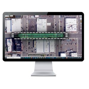
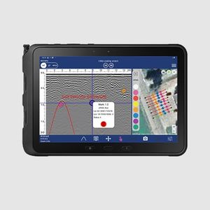
The software is intuitive and easy-to-use and provides effective tools for filter assignment, data processing, marking points of interest, visualising profiles and markers in the site view – including online map support, and exporting markers for geo-referencing within suitable CAD/GIS environments.
The software excels at simplifying the processing and mark-up of multi-line 2D GPR projects but is equally adept at supporting a single-line projects project. Compatible with the project modes in the ImpulseRadar ViewPoint acquisition App, CrossOver and PinPointR data sets can be processed quickly and efficiently. By viewing up to ten parallel profiles simultaneously, anomalies in the data can be more easily resolved, which makes for increased productivity.
Catalogs
No catalogs are available for this product.
See all of ImpulseRadar‘s catalogsRelated Searches
- Automation software solution
- Management software solution
- Analysis software solution
- Process software solution
- Windows software solution
- Computer-aided design software
- Control software solution
- Online software
- Design software solution
- 3D software solution
- Interface software
- Measurement software
- Quality software
- Programming software
- Network software solution
- Engineering software
- 2D software
- Creation software
- Calculation software
- Data acquisition software
*Prices are pre-tax. They exclude delivery charges and customs duties and do not include additional charges for installation or activation options. Prices are indicative only and may vary by country, with changes to the cost of raw materials and exchange rates.


