- Building - Construction
- Construction tool
- Total station with prism
- Leica Geosystems

- Company
- Products
- Catalogs
- News & Trends
- Exhibitions
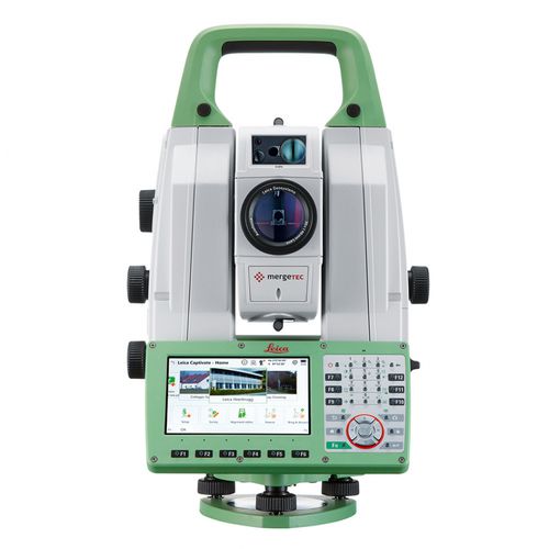
Total station with prism Nova MS60roboticdigitalwith integrated GNSS
Add to favorites
Compare this product
Characteristics
- Type
- with prism
- Operating mode
- digital, robotic
- Other characteristics
- with integrated GNSS, with digital imaging, with 3D laser scanner
Description
The ultimate all-rounder, a scanning, self-learning total station with GNSS connectivity and digital imaging
The Leica Nova MS60, the world’s first self-learning MultiStation, enables you to perform all surveying tasks with one instrument.
The MS60 is a scanning total station that empowers complete data collection of individual points and large areas by leveraging sensor fusion and automation. Seamlessly integrated into Leica field and office surveying software, you can quickly complete your work on-site and offer a range of high-value deliverables.
Highest-end total station
Highly accurate angle and distance measurements, robust design and easy-to-use apps. With improved automated functionalities, like Dynamic Lock and Autoheight, and the self-learning ARTplus features, the MS60 increases your efficiency, even in the most challenging conditions.
3D laser scanning
Scan up to 30,000 points per second (Hz) to complete your work quickly and get dense scanning grids. The MS60 features optimised scanning paths, including zenith scans, allowing you to significantly reduce the total scanning time.
GNSS connectivity
GNSS is fully integrated in the workflow and the data structure, enabling direct georeferencing and increasing your flexibility in the field.
Catalogs
*Prices are pre-tax. They exclude delivery charges and customs duties and do not include additional charges for installation or activation options. Prices are indicative only and may vary by country, with changes to the cost of raw materials and exchange rates.


