- Metrology - Laboratory
- Metrology and Test Equipment
- 3D scanner
- Leica Geosystems

- Company
- Products
- Catalogs
- News & Trends
- Exhibitions
3D scanner RTC360edgefor spatial imagery and topographymeasurement

Add to favorites
Compare this product
Characteristics
- Number of axes
- 3D
- Applications
- measurement, for spatial imagery and topography, edge
- Technology
- laser
- Configuration
- compact, portable
- Other characteristics
- automated, manual
Description
Automatically pre-register point cloud data in the field to quickly conduct quality control checks, improve productivity and make better-informed decisions on site
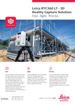
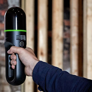
The Leica RTC360 3D reality capture solution empowers users to document and capture their environments in 3D, improving efficiency and productivity in the field and in the office through fast, simple-to-use, accurate, and portable hardware and software. The RTC360 3D laser scanner is the solution for professionals to manage project complexities with accurate and reliable 3D representations and discover the possibilities of any site.
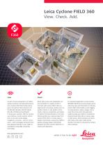
Highly portable, highly automated, intuitive and designed for maximum productivity, the RTC360 solution efficiently combines the RTC360 a high-performance 3D laser scanner, Leica Cyclone FIELD 360 mobile-device app for edge computing for automatically registering scans in real time, and Leica Cyclone REGISTER 360 PLUS office software to integrate your 3D model seamlessly into your workflow.
Capture scans, including enriching High-Dynamic Range (HDR) imagery, in less than two minutes.
Automatically record your moves from station to station to pre-register your scans in the field without manual intervention.
Augment your data capture with information tags illustrating the opportunities for better planning, reflect site reality, and boost your teams’ situational awareness
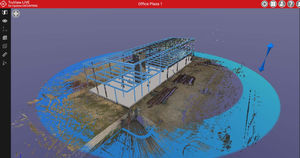
Directly publish your captured data from Cyclone FIELD 360 to Leica TruView Cloud to quickly exchange project information prior to import and registration
VIDEO
Catalogs
Related Searches
- Omnidirectional antenna
- Outdoor antenna
- GNSS antenna
- Laser scanning system
- Measurement scanning system
- 3D scanning system
- External antenna
- Compact antenna
- Mobile antenna
- 4G LTE antenna
- Rugged antenna
- Measurement antenna
- High-resolution scanning system
- High-speed scanning system
- Data transfer antenna
- Tracking antenna
- Compact scanning system
- Precision level
- GLONASS antenna
- Portable scanning system
*Prices are pre-tax. They exclude delivery charges and customs duties and do not include additional charges for installation or activation options. Prices are indicative only and may vary by country, with changes to the cost of raw materials and exchange rates.


