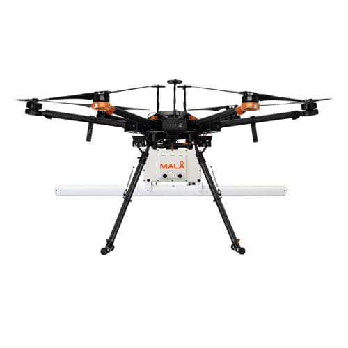
Network detection ground penetrating radar GeoDrone 80


Add to favorites
Compare this product
Characteristics
- Options
- for network detection
- Frequency
80 MHz
Description
It’s an airborne GPR solution for efficient field work, designed specifically for data collection in remote, hazardous and in-accessible areas. MALÅ GeoDrone 80 makes it possible to effectively collect GPR data in a variety of difficult environments, such as snow-covered ground, rocky and uneven terrain, across rivers and in avalanche-prone areas. It’s based on the latest GPR HDR technology by Guideline Geo.
Application areas
The MALÅ GeoDrone 80 is a great solution for many types of airborne GPR surveys. It’s primarily suitable for:
Larger (>1 m) buried targets at less than 10 m depth
Layer detection below 2 meters depth
Bathymetry profiling (e.g. river bottom profiling)
Depth to Bedrock
Detection of larger sinkholes
Detection of larger cavities (e.g. cavities in limestone areas)
Shallow sedimentary structures
Arctic Ice profiling (or other deeper ice/snow measurements)
Liability information
The purchaser must investigate and adhere to the current laws, regulations (e.g. ETSI, FCC) and any required permissions related to the use of airborne GPR in the relevant location of use. Guideline Geo accepts no responsibility nor liability in regards to the above.
The airborne GPR solution
Using our unique MALÅ HDR GPR technology
Support all standard drones with adequate lift power (>3,5 kg)
Optimized for specific critical application areas
Wireless real-time monitoring compatible with other MALÅ GX solutions
Suitable for automated drone surveying
Learn about making Ground Penetrating Radar surveys over water and GPR theory, the considerations for survey design, instrument deployment and data processing when working on water and also show you some case studies.
VIDEO
Catalogs
GeoDrone 80
1 Pages
*Prices are pre-tax. They exclude delivery charges and customs duties and do not include additional charges for installation or activation options. Prices are indicative only and may vary by country, with changes to the cost of raw materials and exchange rates.


