Quadrotor UAV NOVAdrone P800 GPR COBRAcivilianmonitoringinspection

Add to favorites
Compare this product
Characteristics
- Type
- quadrotor
- Applications
- mapping, monitoring, inspection, for industrial applications, civilian
- Other characteristics
- autonomous, lightweight
- Payload
5.5 kg
(12.125 lb)
Description
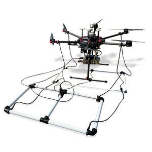
GPR HF/LF antennas for “Air Coupled” surveys with drone
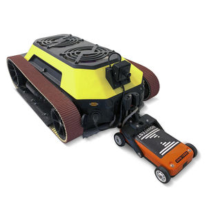
In many cases, GPR surveys can be complex both logistically and in terms of personnel safety due to topographical environments and adverse weather conditions. The drone or rover integrations proposed by Novatest represent a valid alternative to traditional methods, offering a range of advantages in terms of efficiency and competitiveness of the service provided.
The NOVAdrone P800 system with integrated GPR, compared to a manned aircraft or helicopter, not only makes the work safer and more efficient but also brings significant benefits in terms of programmed autonomous low-altitude flights with high precision thanks to the “Terrain Follow” system. A GPR mounted on a drone allows surveys on land, ice, rocks, freshwater, or structures in critical environments without compromising personnel safety, providing an alternative solution for more efficient surveys.
Examples of applications:
- Surveys on rough terrain
- Geotechnical surveys for soil level analysis
- Archaeological surveys for mapping underground infrastructures
- Subservice mapping (e.g., gas pipelines, large water pipes, etc.)
- Location of unexploded ordnance
- Crevasse identification
- Glacier surveys
- Bathymetric surveys in freshwater
Thanks to the possibility of associating different types of GPR antennas with the drone, it is possible to achieve both high-resolution detailed analyses and deep geological surveys.
Catalogs
No catalogs are available for this product.
See all of Novatest‘s catalogsRelated Searches
- Datalogger
- Wireless datalogger
- Monitoring data logger
- Endoscope
- Measurement monitoring device
- Real-time monitoring device
- Data acquisition module
- Flexible endoscope
- Temperature monitoring device
- Video endoscope
- Multi-channel datalogger
- Portable endoscope
- Digital monitoring device
- Flexible video endoscope
- Tracker
- Portable video endoscope
- Inspection crawler
- Benchtop monitoring system
- Current data logger
- Vibration monitoring system
*Prices are pre-tax. They exclude delivery charges and customs duties and do not include additional charges for installation or activation options. Prices are indicative only and may vary by country, with changes to the cost of raw materials and exchange rates.


