
- Products
- Catalogs
- News & Trends
- Exhibitions
Post-processing software EZSurv™positioningdata collectionGNSS reference network

Add to favorites
Compare this product
Characteristics
- Function
- post-processing, positioning, data collection
- Applications
- GNSS reference network
Description
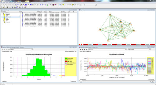
EZSurv is GNSS post-processing software that provides a reliable and efficient RTK offline solution to improve the accuracy of your survey or GIS data. Compatible with industry standards, EZSurv is a straightforward, user-friendly solution that offers 4 processing modes and many unique features.
Want to know more?
Download the Product Overview.
Software:
Please access our Distributor's Corner to download the instruction documents.
Field data collection software compatibility
FieldGenius from MicroSurvey
SurvCE from Carlson Software
ArcPad from Esri
Processing modes
Baseline processing
Kinematic processing – PPK (RTK offline)
Precise Point Positioning – static
Precise Point Positioning – kinematic
Main features
Automatic connection to many base station data providers
Automatic connection to many precise orbit providers
Least squares adjustment tool
Support to most coordinate systems
Many QA tools
VIDEO
Catalogs
No catalogs are available for this product.
See all of PENTAX Precision‘s catalogs*Prices are pre-tax. They exclude delivery charges and customs duties and do not include additional charges for installation or activation options. Prices are indicative only and may vary by country, with changes to the cost of raw materials and exchange rates.
