- Metrology - Laboratory
- Metrology and Test Equipment
- 3D scanner
- Shenzhen Leishen Intelligent system Co., LTD
3D scanner LS seriesfor long-distance measurementsinspectionfor detection
Add to favorites
Compare this product
Characteristics
- Number of axes
- 3D
- Applications
- for long-distance measurements, inspection, for detection, gap
- Technology
- LIDAR
- Other characteristics
- high-speed
- Length
1,550 mm
(61 in)- Measuring distance
250 m, 500 m, 2,000 m
(820'02" , 1640'05" , 6561'08" )
Description
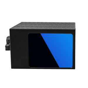
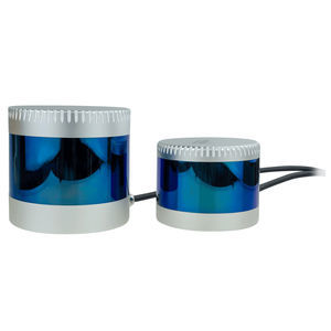
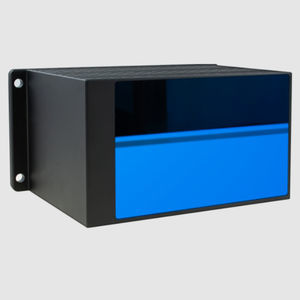
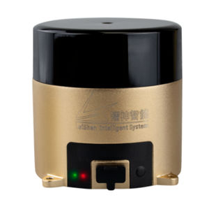
MS series long range LiDAR Scanner products is based on TOF principle. It scans at a high speed at an angle of 360° & 120°. The detection distance is up to 2000m with ±2cm accuracy. Widely used in HD maps, smart cities, city 3D modeling, land survey, fire emergency, power inspection, track inspection, mine inspection, tunnel inspection, forest inspection, bridge anti-collision and other fields.
High definition
Light weight design
High accuracy up to 2cm
During the flood season, the river’s water level fluctuates a lot, and the distance from the bridge to the water surface is difficult to determine by the vessels to be passing throught, and the distance above the waterline also changes when the ship is loaded or unloaded. It is difficult for the ship driver to know exactly whether the height of the ship meets the gap, so ship driver can only roughly judge it based on experience. As a result, ship collision accidents have occurred frequently in the flood season for many years, which seriously threatening the safety of the bridge.
Aiming at the safety of ships passing through bridge , based on the self-developed long-distance lidar LS30M, a bridge collision avoidance solution was proposed.
The core of this solution is long range LiDAR scanner, which is installed on both sides of the bridge pillars. As shown in Figure in the left, the installation height of the LiDAR is the height limit of the bridge. The two LiDARs cross to detect the ship. When the ship is higher than the height limit of the bridge, at least one of LiDARs will detect the ship and the system will output an alarm signal.
Catalogs
LS30MVA
1 Pages
LS-S1 Series
1 Pages
Other Shenzhen Leishen Intelligent system Co., LTD products
PRODUCTS
Related Searches
- Laser scanning system
- Measurement scanning system
- 3D scanning system
- Inspection scanning system
- 2D scanning system
- High-speed scanning system
- High-precision scanning system
- LIDAR scanning system
- Optical scanning system
- Security scanning system
- Ethernet scanner
- Detection scanner
- Fixed scanning system
- Mapping scanning system
- Wireless scanner
- Infrared scanner
- IP67 scanner
- POS scanner
- GNSS scanner
- Gap scanner
*Prices are pre-tax. They exclude delivery charges and customs duties and do not include additional charges for installation or activation options. Prices are indicative only and may vary by country, with changes to the cost of raw materials and exchange rates.


