Noise simulation software SoundPLANessentialacoustic simulationinterfacedevelopment
Add to favorites
Compare this product
Characteristics
- Function
- acoustic simulation, noise simulation, interface, development, calculation, graphic
- Applications
- industrial
- Type
- 3D
- Operating system
- Windows
- Deployment mode
- online
Description
Modelling the geometry
The geometry is either digitized on the screen on the basis of a bitmap or imported if digital data is available. In addition, an interface to Google Maps is available to you.
Intuitive, graphical model data editing
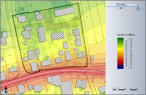
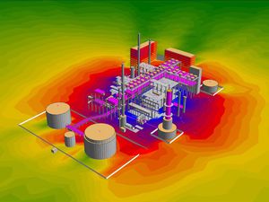
The sound sources (roads, railways, parking lots and point, line and area sound sources) and the objects that influence the sound propagation path (e.g. buildings, noise barriers or ground properties) are entered in the site map and equipped with acoustical properties. The data model is completed with receivers for a single point calculation or the calculation area for two-dimensional contour maps. All objects can be displayed in the front view and in the 3D Graphics, where they can also be checked for a coherent model.
Definition of the emission
SoundPLANessential allows you to calculate noise emissions from roads, railways, industrial sources and parking lots. The extensive emission library already provides you with a large selection of spectra, to which you can add your own spectra at any time.
Parallel calculations through multicore and multithreading
With the quality-tested original SoundPLAN calculation kernel, compliant calculations of road, rail or industrial noise are performed quickly and efficiently.
Tabular documentation
The emission parameters of the different sound sources and the results including the partial levels and dispersion parameters are documented in tables in a clear and understandable way, which you can easily include in your reports.
Graphical presentation of the results
The results of individual places of immission are cartographically edited as small tables together with the model data.
Catalogs
Related Searches
*Prices are pre-tax. They exclude delivery charges and customs duties and do not include additional charges for installation or activation options. Prices are indicative only and may vary by country, with changes to the cost of raw materials and exchange rates.


