- Products
- Catalogs
- News & Trends
- Exhibitions
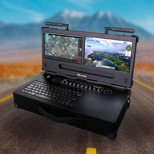
UAV ground control station TIM-UT200with touchscreen


Add to favorites
Compare this product
Characteristics
- Options
- for UAVs
- Other characteristics
- with touchscreen
Description
Air and ground synergy, everything under control thousands of miles away,make mission deployment and team collaboration more flexible and flight safer
Strong empowerment for the integration of open space
Ergonomic Design
HD 10 inch 1920*1080
5 hours of battery life
Dust-proof design
Rainproof design
Mission Pod Integrated Control
Remote control and flight control
3D modeling software
Using complex photogrammetry, computer vision and computer geometric algorithms and other technologies, only relying on a set of standards, continuous oblique aerial photography and close-up photography collected on the ground can automatically build a fine-structured three-dimensional grid model, realizing urbanization. Full element modeling of buildings, trees, roads, walls. It has the characteristics of authenticity, measurability, and fast speed, which can realize rapid restoration of various business scenarios of smart cities.
Ground station integrated management software
The ground comprehensive management software is a ground receiving display and management platform software developed for the UAV image transmission system. The system realizes real-time UAV image access display, flight attitude monitoring, route planning, flight speed monitoring, real-time display of flight trajectory, and real-time display of various UAV attitude data: altitude, speed, power, wireless signal strength, etc. In addition to realizing real-time control of the aircraft, it can also control various functional pods such as photoelectric, throwing, shouting, and poisonous gas. It is powerful, safe and reliable.
Related Searches
- Monitoring drone
- Inspection drone
- Mapping drone
- Autonomous drone
- Drone for industrial applications
- Fixed-wing drone
- Gyro-stabilized turret
- Lightweight drone
- Carbon fiber drone
- UAV gyro-stabilized turret
- Composite UAV
- GCS
- UAV GCS
- 3-axis gyro-stabilized turret
- Reconnaissance UAV
- Tethered drone
- Ground control station with touchscreen
*Prices are pre-tax. They exclude delivery charges and customs duties and do not include additional charges for installation or activation options. Prices are indicative only and may vary by country, with changes to the cost of raw materials and exchange rates.


