
- Products
- Catalogs
- News & Trends
- Exhibitions
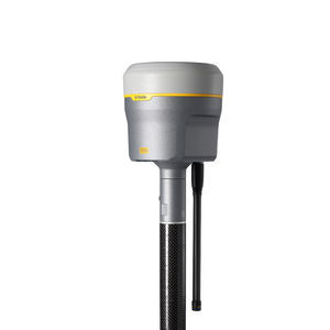
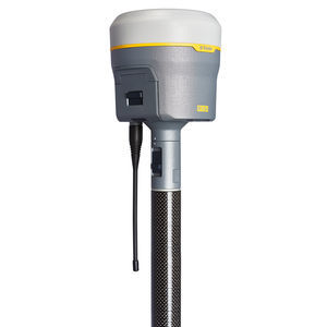
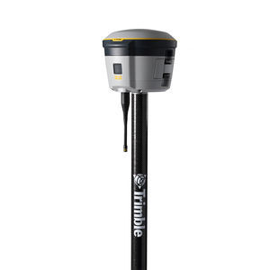
GNSS surveying system R2
Add to favorites
Compare this product
Characteristics
- Options
- GNSS
Description
Accuracy. Versatility. Flexibility.
The Trimble® R2 GNSS system is a compact, durable, flexible and easy-to-use GNSS receiver for GIS and survey professionals. Collect highly-accurate data in a wide range of geospatial applications with submeter to centimeter positioning accuracy.
Key specifications
This versatile, rugged GNSS receiver is perfect for a variety of GIS and surveying needs.
Work how you want
Choose accuracy levels ranging from submeter to centimeter and select GNSS performance level to support any GIS or survey-grade workflow.
Multiple ways to pair & mount
Pair with a smartphone, tablet or Trimble handheld or controller running Trimble Access™ and Trimble TerraFlex®. Operate on a survey pole, backpack or vehicle.
Simple to operate in the field
Its one button start-up and compact, cable-free design means R2 is fast to set up and easy to use, keeping you productive and focused on your task at hand.
Choose correction sources
Get higher accuracy in real time. Select correction sources from RTK, VRS networks or Trimble RTX™ correction services by satellite and internet/cellular.
Catalogs
No catalogs are available for this product.
See all of Trimble‘s catalogsRelated Searches
- GNSS receiver
- Precision level
- Total station
- Surveying receiver
- Reflectorless total station
- Automatic total station
- Digital level
- Total station with prism
- Optical level
- Automatic level
- Robotic total station
- Manual total station
- Monitoring receiver
- Surveying system
- Monitoring total station
- Field controller
- GNSS surveying system
- Portable mapping system
- Rugged field controller
- Mobile mapping system
*Prices are pre-tax. They exclude delivery charges and customs duties and do not include additional charges for installation or activation options. Prices are indicative only and may vary by country, with changes to the cost of raw materials and exchange rates.


