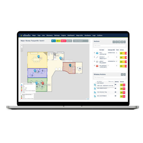
Location engine is the application used for the configuration, testing, management and supervision of RTLS.
The same Location Engine account can be used to compute positions on the same map with different technologies simultaneously.
Manage anchors placement through drag-and-drop, check their status and battery level.
Monitor anchors activity
The status of the anchors is shown directly on the map using a colour code.
Anchors placement
Drag-and-drop your anchors to place them correctly on the map
Remote battery management
Check the real-time battery levels of your wireless anchors
Configure the anchors and apply it to the devices directly from your desk.
Configure easily all your anchors over the air
Verify and modify the anchor configuration without having to physically connect to the gateway on-site.
Hybrid configuration
The Ubudu Hybrid Anchors V2 can be configured to scan both BLE and UWB signals simultaneously.
Adjust the height
Input the exact height at which each anchor is installed to ensure best accuracy.
This view shows real time tags positions computed and enables you to see which anchor is receiving signal from which tag for fine-tuning.
Real time view
See the real-time position of the tags on the map.
Position computation details
Quickly identify which anchors are used for position computation.
Fine-tuning
See which anchor is receiving signal from which tag to fine-tune the set-up and get the best results


