- Robotics - Automation - Industrial IT
- Industrial Software
- Viewer software
- Zikmund electronics s.r.o.

- Products
- Catalogs
- News & Trends
- Exhibitions
Measurement software viewerinspectionprinting


Add to favorites
Compare this product
Characteristics
- Function
- measurement, viewer, inspection
- Applications
- printing, pipe
- Operating system
- Windows
Description
SOFTWARE - INTUITIVE AND USER-FRIENDLY
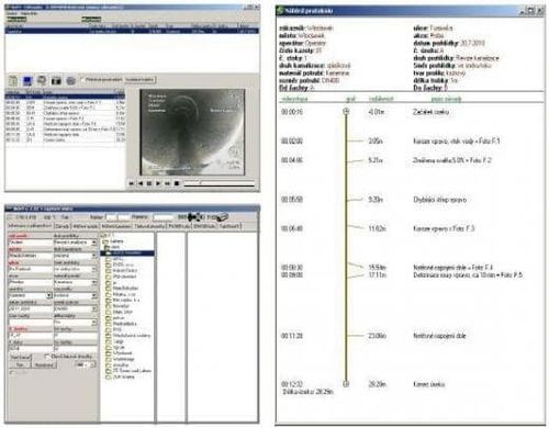
Our software produces graphical reports on inspected sections and has the following functionality:
- Shows graphs with angles of tilt
- Measures ovality via comparison with an assistance ring on the display
- Laser measurement of ovality & widths of cracks and gaps
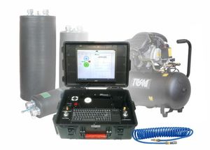
- Measures sections via pressure testing
- Batch printing of documents
- Graphical ring indicating the direction of the camera head
- Operates to ATV and EN13508-2 standards
Measuring with a laser allows distances to be calculated (e.g. levels of water in caverns). The software features an Isybau module to facilitate easy import into a GIS system, the development of which we have contributed to significantly.
The software comes with a viewer that provides a clear overview (see the image below). Apart from viewing a video feed, users have the option to take screenshots at any time, print reports and produce charts detailing tilt and groundwater inflow. An open license is granted for normal use of the viewer.
INTUITIVE AND CLEAR
ISYBAU MODULE IS INCLUDED
TRAINING IS FREE
*Prices are pre-tax. They exclude delivery charges and customs duties and do not include additional charges for installation or activation options. Prices are indicative only and may vary by country, with changes to the cost of raw materials and exchange rates.


